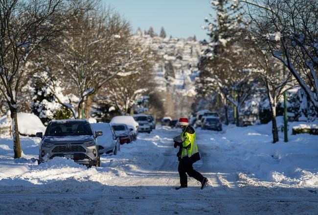
FREDERICTON — There is a complex, counterintuitive relationship between rising global temperatures and the likelihood of increasingly intense snowstorms across Canada.
Winters are becoming on average milder and warmer than they used to be, but there has also been a noted rise across the country in extreme weather events, such as intense snowstorms, said John Clague, a professor of geosciences at Simon Fraser University, in Burnaby, B.C.Â
People might think it illogical that parts of the country are seeing more snowstorms as the climate warms, he said. "What climate modelers are finding is that climate change involves more frequent extremes."
"That means during summer, you can have extreme high temperatures, kind of life-threatening high temperatures, such as they've experienced in India and Pakistan in recent years. And you also can have, during winter, these extreme cold conditions."
One of the reasons for the extremes involves the jet stream — defined by Environment Canada as "a narrow band of strong winds about 10 kilometres above the Earth, marking the dividing line between warm and cold air masses."Â
Clague said the jet stream, which moves from west to east and carries weather systems with it, is moving more slowly than it normally does and seemingly parking itself over an area for a period of time. The mass of cold or hot air that it's carrying lingers in the atmosphere where it clashes with moisture-laden currents, causing heavy snow or rain, he said.Â
"This interface between this moist, tempered air at lower latitudes, and the cold, drier air — Arctic air — generates snowfall."Â
Kent Moore, an atmospheric physics professor at the University of Toronto, said it's a paradox that climate change is producing more intense snowstorms. There is some evidence to show that the warming Earth is changing the dynamics of how the jet stream works, he said.
The jet stream can have "larger undulations" as the climate warms, which means it simply doesn't go west to east but sometimes travels north or goes south like a wave, he said. It also tugs Arctic air along with it as it moves southward, he added.
"There's some evidence that as the climate is warming, the jet stream is becoming more wavier," Moore said.Â
The interplay between diminishing sea ice and a fast-warming Arctic is reducing the temperature gradient from the southern tip of the country to the north, he said. And a wavier — or weakened — jet stream is bringing Arctic air south, creating intense snowstorms, he added.
Oceans on either coast also play a role because the warming climate produces more evaporation of water, Moore said. "That means that there's more water vapour in the atmosphere, which means that there's more snow as well because of that."
Blair Feltmate, head of the Intact Centre on Climate Adaptation at the University of Waterloo, said warmer air holds more moisture and has more heat energy than does colder air. "That often results in severe precipitation in the form of more rain in the summer and snow-blasts in the winter,” he said.Â
Global average temperatures have increased by about 1.1 C to 1.2 C over the past century, he said, adding that Canada has warmed up even more. The southern half of Canada has been warming around two times that of the global average, he said. The northern half, meanwhile, has been heating up around three times faster, he added. Â Â
"This is creating atypical or non-typical weather in different areas of the country. It's not just that we might have more snowfall, as we are seeing now, we can have extreme cold snaps as well."
Feltmate said the intensity of the top one per cent of precipitation events that occur in a single year has increased over the last six decades, by about 37 per cent toward the western end of the Great Lakes and 72 per cent toward the east.Â
Moore, who has studied snowfall in the Toronto region, said the amount of accumulation over a typical winter is becoming smaller while the volume of rain is increasing. "That doesn't mean you can't have a really, really intense storm that dumps a ton of snow in just a few days. That can still happen, even though in the long term, the trend is toward less snow."
Feltmate said the symphony of winter storms from Vancouver to Toronto and the Maritimes can be attributed to climate change. He used a baseball analogy to illustrate the link between climate change and recent severe weather events — the heat dome, atmospheric rivers, post-tropical storm Fiona, and "mammoth" snowstorms.
"It's a little bit like saying you have a baseball player who's gone on steroids. And all of a sudden that baseball player starts to hit five times as many home runs," Feltmate said.
"You can't say that any single home run is due to the steroids. But if he or she is hitting five times as many home runs, then you can pretty much say cause and effect is going on between taking the steroids and hitting home runs. With climate change, we have extreme weather on steroids — and the steroids are here to stay."
This report by The Canadian Press was first published Dec. 24, 2022.
Hina Alam, The Canadian Press


