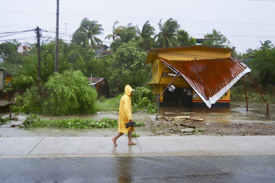
MARQUELIA, Mexico (AP) — Hurricane John fell apart as quickly as it formed but left destruction along Mexico's southern Pacific coast Tuesday, including deadly mudslides and flooding that may linger for days.
John was a Category 3 hurricane when it made landfall late Monday night near the town of Punta Maldonado, with winds of 120 mph (190 kph). It weakened to a tropical depression Tuesday with maximum sustained winds of 35 mph (55 kph), the U.S. National Hurricane Center said.
Mexican authorities discontinued all tropical storm warnings as the storm system dawdled along the coastal mountains and continued to weaken. It was 70 miles (115 kilometers) northwest of Acapulco and moving northwest at 3 mph (6 kph) at midday.
John blew tin roofs off houses, triggered mudslides and toppled scores of trees.
Two people died when the storm sent a mudslide crashing into their house on the remote mountain of Tlacoachistlahuaca (TLAH-ko-chis-tla-waka), further from the coast. Guerrero Gov. Evelyn Salgado said. A third death occurred in Malinaltepec when a landslide hit the home of a 70-year-old woman, according to Guerrero state officials.
No deaths or injuries had been reported so far in the town of Marquelia, near where the hurricane made landfall, which Mayor Lincer Casiano Clemente attributed to his ability to warn residents of the storm’s approach. But power was knocked out along large parts of the coast, and highways were blocked by fallen trees. The government said some 60,000 people remained without power.
“We’ve never seen such strong gusts,” the mayor said. "There are a lot of houses, mainly the ones with sheet roofing, where the force of the air blew off the roofing.”
By Tuesday morning, people were out looking for food, he said.
U.S. forecasters said the main concern was flash flooding in the coming days. Through Thursday, between 25 and 50 centimeters (10 and 20 inches) of rain could fall along the Oaxaca coast to southeast Guerrero, with isolated higher amounts in places.
Monday's unexpected surge in strength caught scientists, authorities and residents of the area by surprise, something AccuWeather Senior Meteorologist Matt Benz attributed to .
As a result, surprise surges in hurricanes' strength have become increasingly common, Benz said.
“These are storms that we haven’t really experienced before,” he said. “Rapid intensification has occurred more frequently in modern times as opposed to back in the historical record. So that’s telling us there’s something going on there.”
The region was walloped by another rapidly intensifying hurricane, Otis, in 2023.
Otis , where residents had little warning of the strength of what was about to hit them. One of the most rapidly intensifying hurricanes ever seen, scientists at the time said it was .
Otis blew out power in the city for days and left bodies scattered on the coast. Much of the city and thousands scavenged stores for food and water.
Oaxaca and other parts of the Pacific coast seemed to have avoided the devastation witnessed last year in Acapulco.
___
AP writer María Verza in Mexico City contributed to this report. Follow AP’s coverage of Latin America and the Caribbean at
Luis Alberto Cruz, The Associated Press


